PearlyBooks
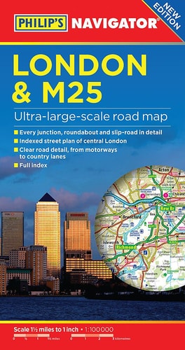
Philip's London and M25 Navigator Road Map by Philips
Philip's London and M25 Navigator Road Map by Philips
Condition Details
Condition Details
- New: Brand new and unread.
- Like New: Almost new condition, unread, however may have some slight shelf wear.
- Very Good: Some have been read & some unread, however books will show some signs of light wear/creases or light damage, may be missing dust jacket.
- Good: Some have been read & some unread, however books will show signs of wear/creasing/marks/tears or damage to cover, may be missing dust jacket.
Low stock: 1 left
Couldn't load pickup availability
PHILIP'S BEST-SELLING RANGE OF BRITISH AND EUROPEAN MAPS 'The clearest and most detailed maps of Europe' David Williams MBE, CEO, Gem Motoring Assist. - The perfect planning maps for your trip to France and Belgium - Scale 16 miles to 1 inch=1:1,000,000 - Double-sided folded map with full index of place names - Super-clear mapping - All major routes shown - Detailed Navigator mapping of Chatham in the east to Maidenhead in the west, and from Hemel Hempstead in the north to Gatwick Airport in the south - AutoRoute junctions, restricted junctions, toll motorways and pre-pay motorways - Gradients - Tourist attractions - Detail of hundreds of individually named farms, houses and hamlets. Also shown are airports, airfields, stations, ferries, canals, marinas and an abundance of places of interest.
Publisher: PHILIP SPublication date: 2017-03-09
Pages: 0
Binding: Paperback
ISBN: 9781849074384-LN
Dimensions: 132.0 x 242.0 x 10.0 mm
Weight: 0.105 kg
Share